What do you get as a result?
The results of our analyses are presented as clear, actionable project recommendations for:
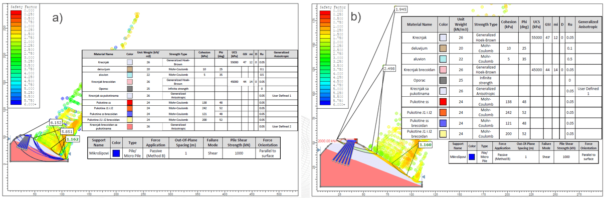
- dimensioning of structures, anchors, retaining structures and other protective measures
- defining permissible excavation stages and construction sequence
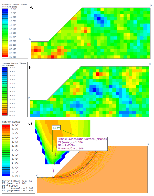
- additional investigations where risks exceed the reliability of available data
- assessment of residual risks with proposed mitigation measures
This approach ensures that techno-economic decisions are based on realistic calculations rather than assumptions.
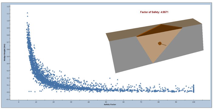
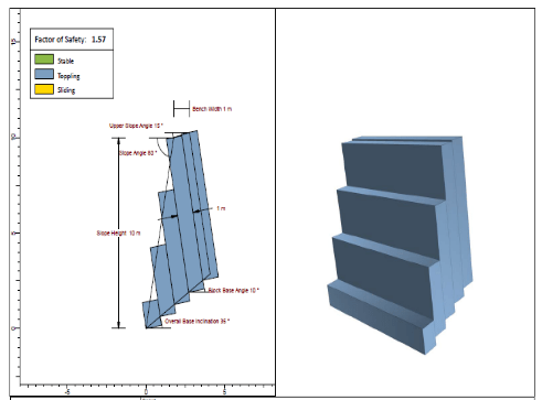
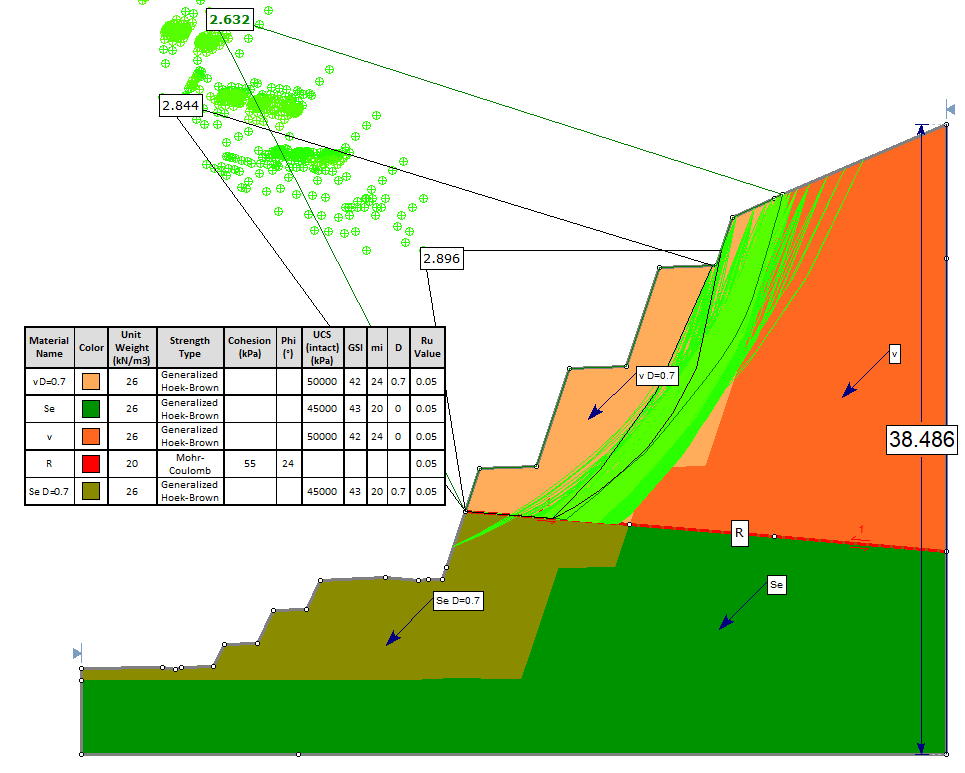
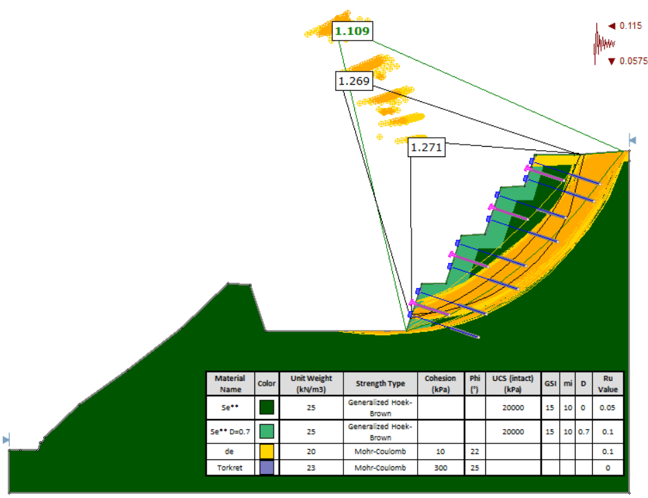
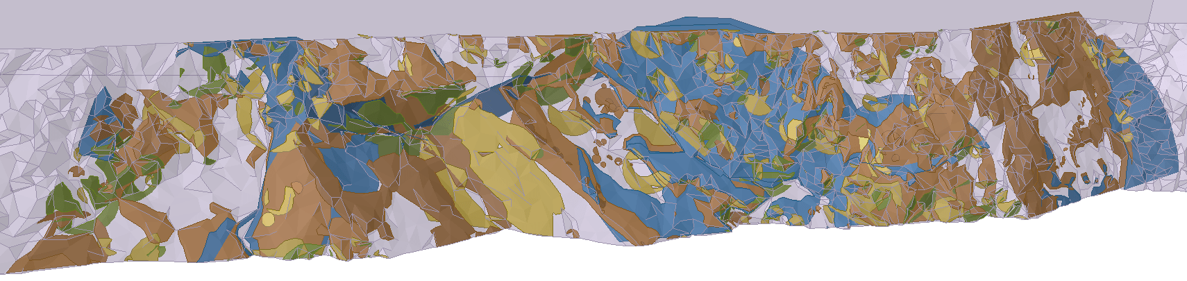
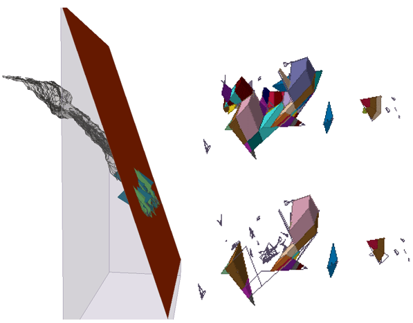
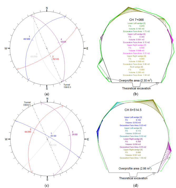
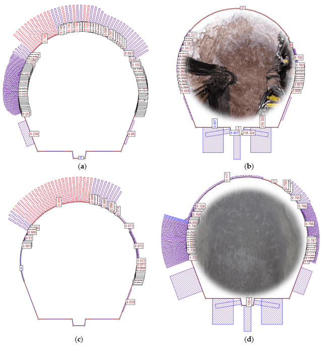
Analyses are performed in accordance with Eurocode 7 and relevant regulations, using advanced software tools and, where necessary, verifying results through multiple methods to ensure reliability.